Google Maps APIs & SDKs
More than a dozen APIs and SDKs from the areas of Maps, Routes, Places and Environment ensure easy integration into map applications for Android and iOS as well as for web services.
Google Maps Platform bundles all Maps Services
With Maps, Routes, Places and Environment, the Google Maps Platform combines all services for developing interactive maps and integrating them into your own applications: With Maps, static and dynamic maps, Street View images, 360-degree views and more can be integrated into websites. Routes can be used to create route calculations based on current traffic information. Places provides location data for more than 150 million places worldwide. The Environment section analyzes and presents data that is intended to contribute to a more sustainable world.
Maps
Display the real world with user-defined, flexible static and dynamic maps, Street View images and 360° views.
Dynamic Maps JavaScript DocumentationAerial View
Create realistic 3D aerial images of buildings and locations in the style of a 360° drone flight. This allows your users to get as complete a picture as possible of a location and get a first impression of the surroundings.
more about Aerial View APIDynamic Maps
Dynamic Maps JavaScript DocumentationVector tiles enable faster loading of the map, smoother interaction and automatic detection of marker collisions on the map. With a WebGL overlay, you can also create immersive 3D map displays to make the experience even more interactive for your users.
Cloud Based Map Styling offers advanced design and customization options to adapt the map you create even better to your requirements.Define yourself which types of locations and how many stores you want to display on the map.
With the help of Advanced Markers, you can create highly customizable and performance-optimized Google Maps pins.The possibilities are so diverse that we have created an open source library for the Advanced Marker together with Google. This makes it easier for developers to create individualized markers.

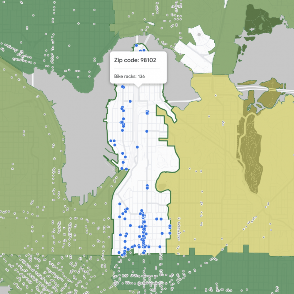
Data-driven styling offers you the option of using Google's administrative boundaries and coloring them according to your logic. You can find an exemplary presentation of the features in our demo of Data-driven Styling for Boundaries and the demo of Data-driven Styling for Datasets.

Map Tiles
Create immersive map visualizations with high-resolution, photorealistic 2D and 3D tiles. The Map Tiles API can be seamlessly combined with other APIs, so you can easily display POIs, routes and much more in a photorealistic map and provide your users with an impressive experience.Take a look at some of the possibilities of 3D Tiles in our demo.
View the Map Tiles API documentation

Dynamic Street View & Static Street View
Use the Google Street View API to access 360° images of specific streets and embed them in a panorama. Static (non-interactive) Street View panoramas or corresponding thumbnails can be embedded in your website without JavaScript.
Dynamic Street View JavaScript Static Street View API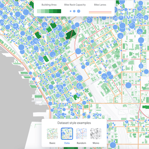

Maps Datasets
With the Maps Datasets API, you can upload your own set of geodata to the Google Cloud Console and then color the data in your own logic to make connections more visible.
More about Maps Datasets API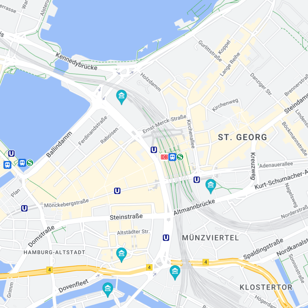

Static Maps
Static map images can be embedded into your website with minimal code effort. You can center the map, add custom markers, define the map type and more.
View Static Maps API DocumentationRoutes
Thanks to comprehensive data and real-time traffic information, users can find the best route from A to B.
Routes
Routes API is the performance-optimized version of the existing Directions API and Distance Matrix API.

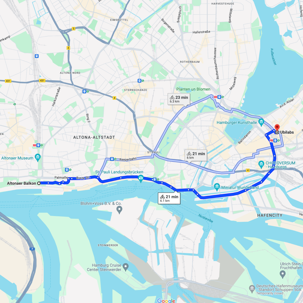
With the Compute Routes API, you can create route descriptions with real-time traffic information using advanced functions. Help your users to find the best route from A to B using different modes of transport.
The Compute Routes Matrix API enables performance-optimized calculation of travel time and distance for multiple destinations.
More info on the Routes APIPlaces
Provide your users with comprehensive location data for over 250 million POIs via the Places API. Use phone numbers, addresses and other data to find specific locations.
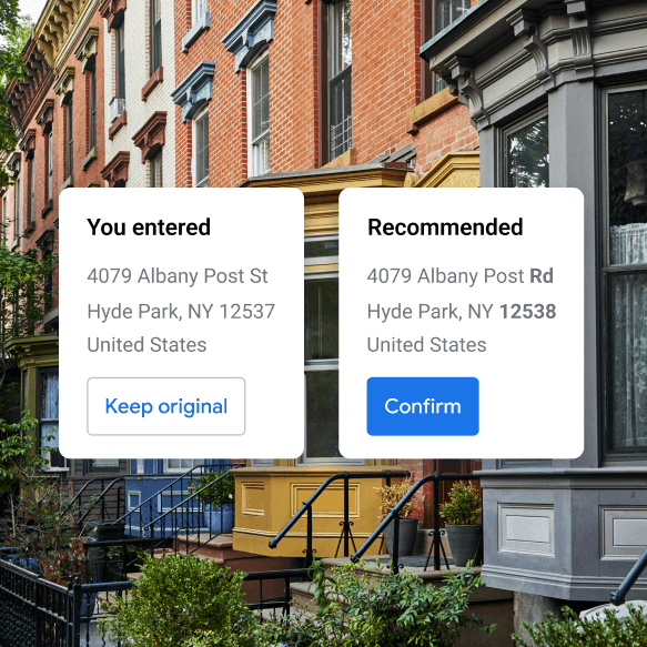

Address Validation
With address data validation via the Google Maps Platform, you can validate and correct your address data. Typing errors and delivery returns due to incorrect address data are now a thing of the past.
Go to the Address Validation APIAutocomplete
Improve the user experience of your application by simplifying the search for companies, addresses or locations with automatic suggestions.
Go to Autocomplete API More information on Autocomplete JSGeocoding
Convert addresses into geographical coordinates and vice versa. This allows you to convert addresses into a physical location that can be displayed on your Google Map.
more information on Geocoding API learn more about Geocoding JavaScript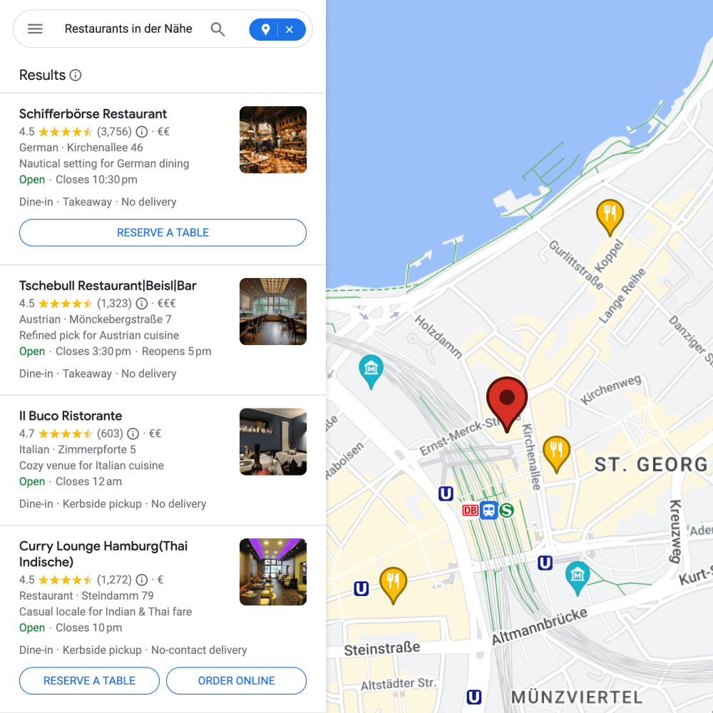

Place Search
Thanks to Text Search, your users can create a list of relevant locations based on search terms such as "pizza in Hamburg".
View the documentation for Text Search API Go to Place Search JavaScriptUse Find Place to identify suitable POIs based on information such as name, address or telephone number. This service is integrated in the new Places API in Text Search.
You can use the Nearby Search to search for nearby locations in various categories.
Mehr about the Nearby Search API More information on Place Search JavaScript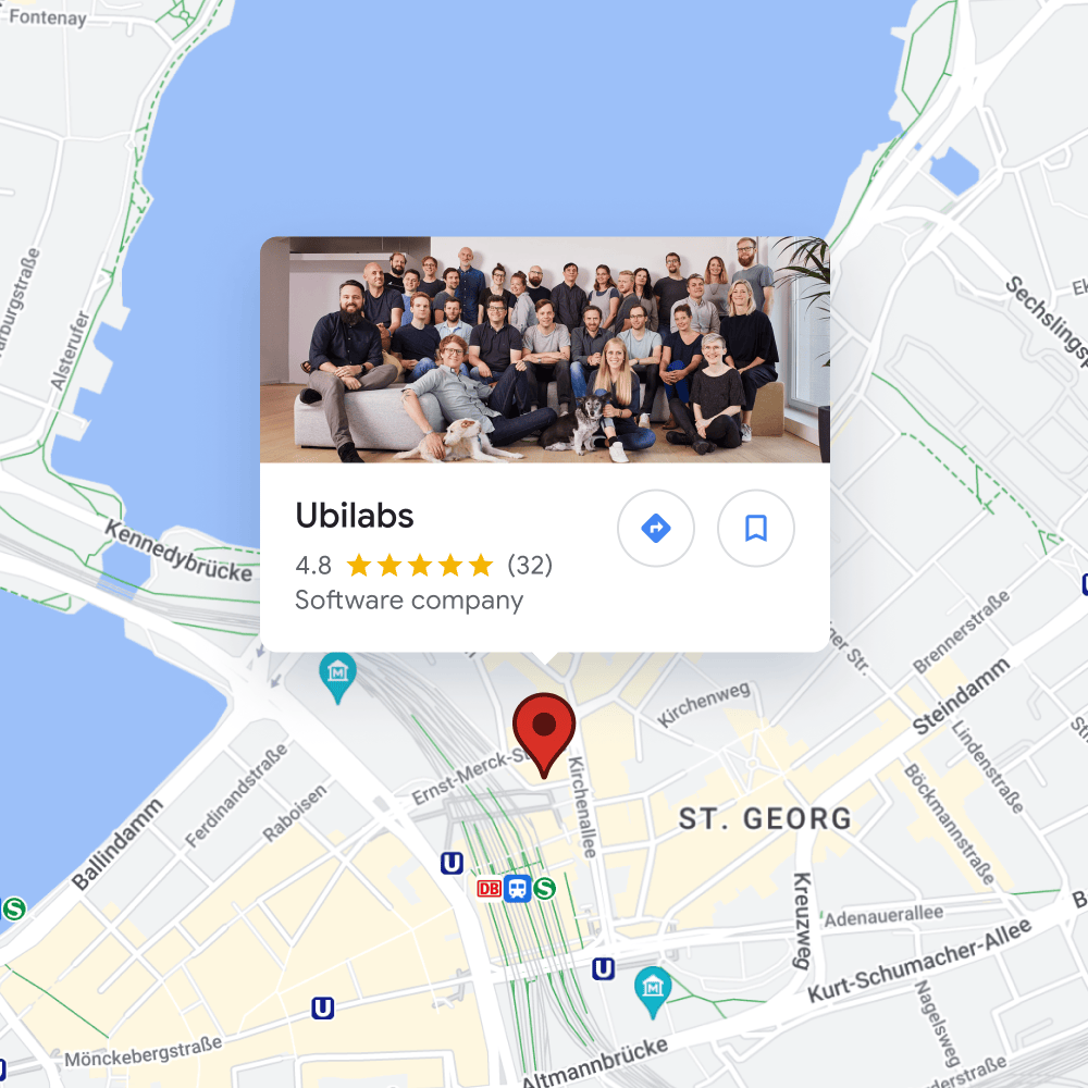

Place Details
Request information such as the full address, phone number, user ratings and reviews for a location.
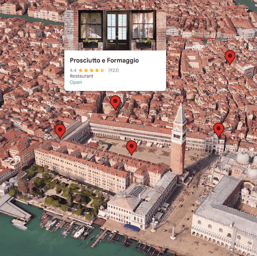
Go to Place Details API documentationPlace Photos
With the Places Photos API, you can add photos from the Google database to your POI entry in Google Maps and give users a better picture of your brand in advance.
More about the Place Photos API

Places UI Kit – Integrating Place Details into Any Map
The Places UI Kit adds a new option for front-end development to the Places API. It provides pre-built UI components that significantly simplify and accelerate the integration of detailed Places data, such as photos, reviews, and opening hours.
The following components are currently available:
- Place Details
- Place Search
- Basic Place Autocomplete
- Elevation (experimental)
The unique feature: The components are map-agnostic. For the first time, this allows you to display Google's extensive place data on maps from other providers, like Mapbox or OpenStreetMap.
Learn more about the Places UI KitEnvironment
With the latest environmental data on specific locations, you can create map applications that have a positive impact on your users' lives, from assessing the solar potential of a building to providing behavioral tips for allergy sufferers.
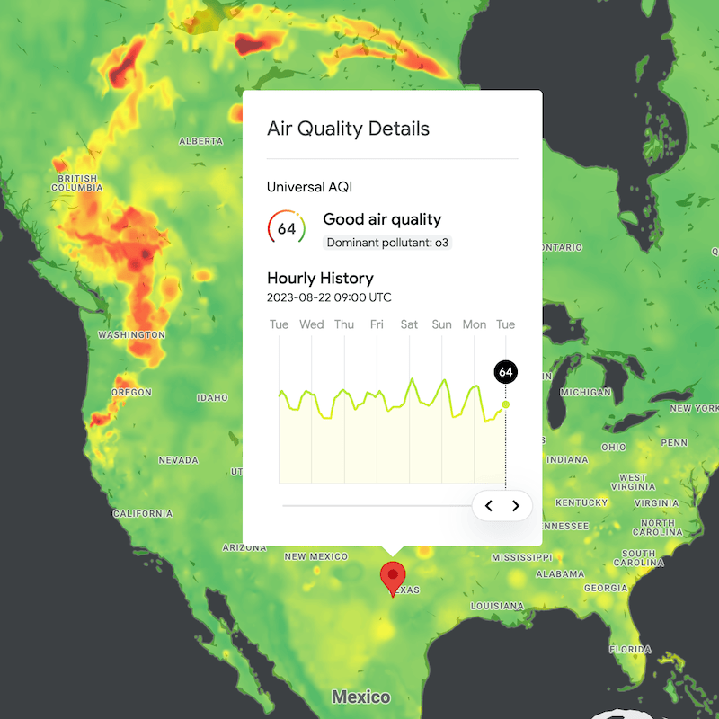

Air Quality
Create meaningful map applications with air quality data. The data is stored historically and updated hourly to identify trends and developments and make predictions.
Go to documentation for Air Quality API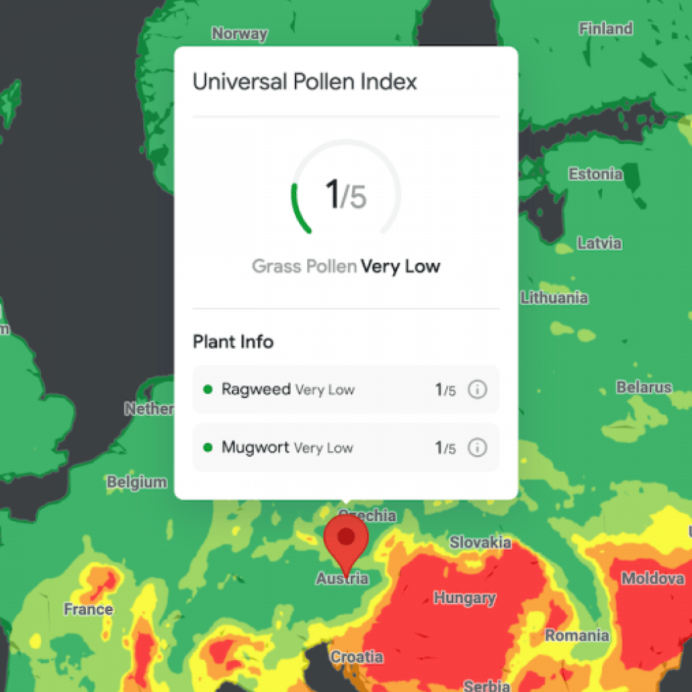

Pollen
Use this interface to obtain both historical and hourly updated data on the pollen count in a specific area. You can use this data to provide allergy sufferers, for example, with a better data basis for their symptom management.
More about Pollen API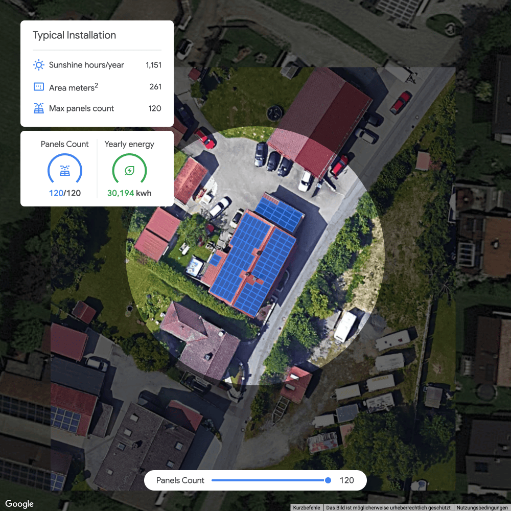

Solar
Calculate the potential for solar energy on individual roofs, or visualize this for entire cities and communities.
Explore Google's Solar APIManual: Your Google Maps API key in 5 steps
To use the Google Maps Platform you need a Google Cloud Console user account and a valid credit card.
Log in to Cloud Console with your Google Account
Add a billing account
Create a new project
Select which APIs and services you need and unlock them.
Then create an API key under credentials, restrict it and include it in your source code.
Need support or prefer to pay by invoice? We will be happy to create a billing account for you and to advise you on questions regarding integration and use of the Google Maps Platform. Contact us at maps@ubilabs.com or call us on +49 40 60 94 661-98.
Partner advantages for license distribution and consulting
We are a leading Google Cloud Partner specializing in Google Maps in DACH – and offer you a number of advantages:
- Google Cloud from a single source: Maps, Cloud and GSuite
- Price advantages especially for larger volumes
- Free 200 $ credit for Google Maps usage
- Personal consulting on the integration and optimal ROI of Google Maps
- Reliable support from dedicated contact person
- Payment by invoice instead of credit card
- For corporations: framework agreements & settlement to cost centers