-
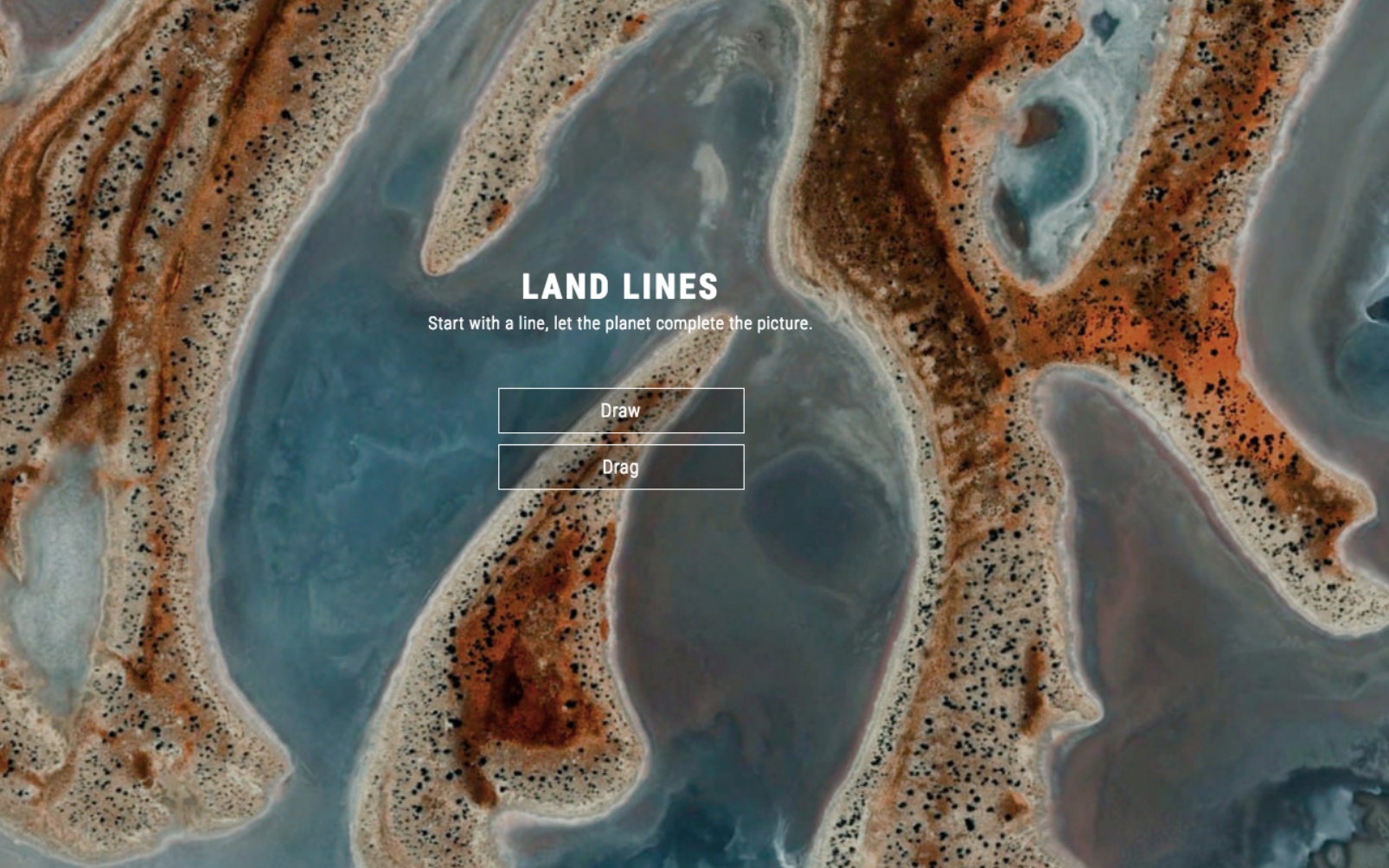

Land Lines is a fascinating creative experiment based on Google Earth images. (Source: Screenshot Land Lines) -
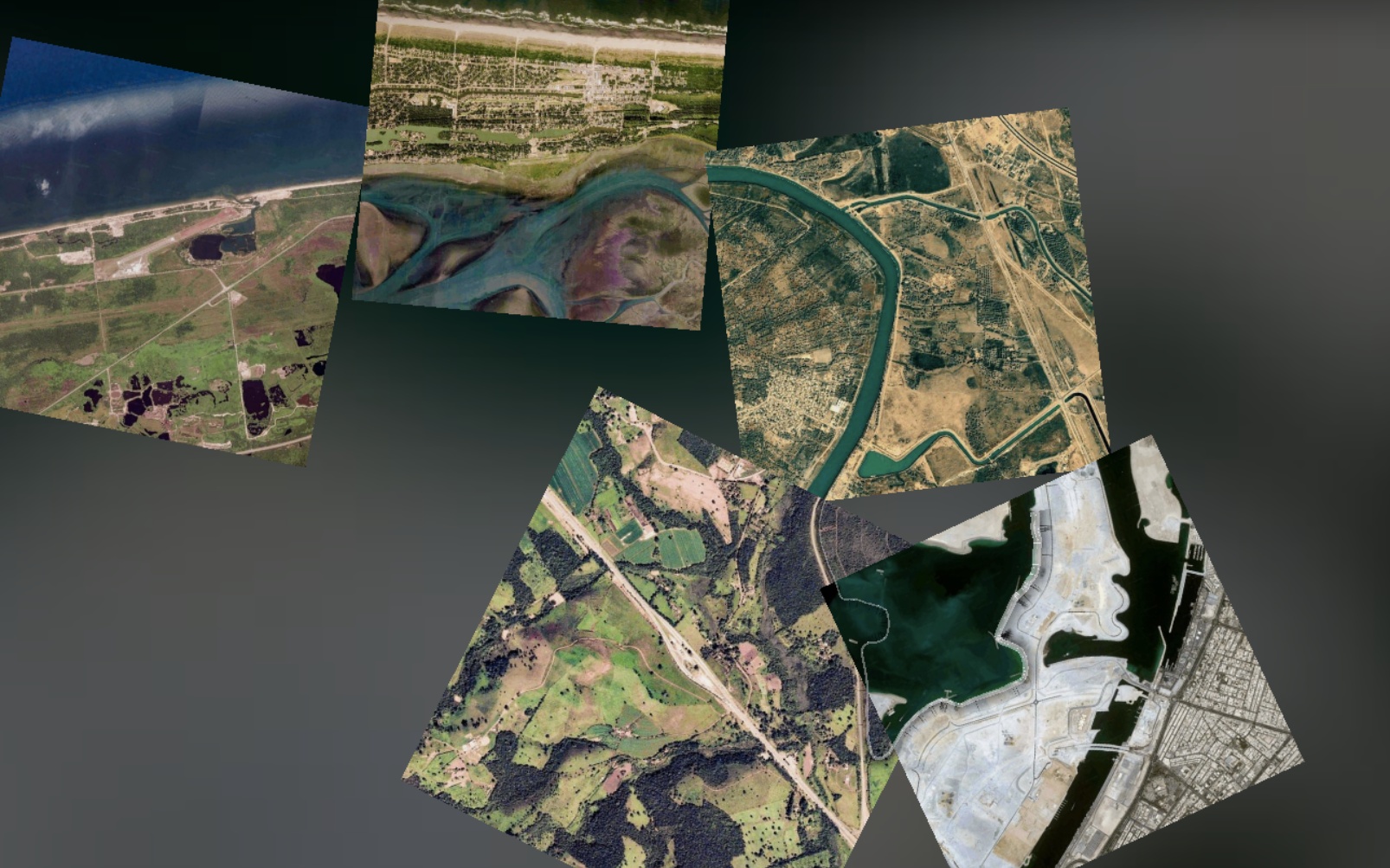

Choose Drag and draw a line – Land Lines will follow the direction of your scribbles with matching Google Earth images. (Source: Screenshot Land Lines) -
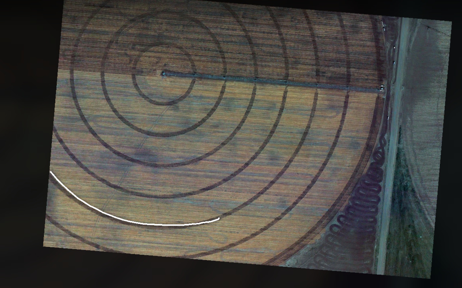
Land Lines' Draw function analyzes your scribbles and finds satellite images that match your lines. (Source: Screenshot Land Lines)


Land Lines: Webby Awards Winner 2017
A creative experiment with Google Earth’s satellite images won this year’s Webby Award in the Netart category. Land Lines is a project by artist Zach Lieberman and the Google Data Arts Team with support by Ubilabs. We analyzed more than 50,000 satellite images and identified the strongest ones visually for a fascinating user experience. Since 1996, the Webby Awards have honored excellence on the internet in media types such as advertising, video, digital audio, websites, and apps.
Exploring the planet with gestures
Get creative with Land Lines and peruse visually compelling Google Earth imagery in completely new ways. Using the “Draw” function, your scribbles will produce satellite images that show exactly those lines. With “Drag”, Land Lines comes up with a stream of map sections that follow the line you are drawing on your device. Pro tip: Once you’ve tried the “Drag” function on your mobile device, you won’t be able to stop! Check out Zach Lieberman’s YouTube video to see how it’s done.
As a supporter of Land Lines, Ubilabs is really happy about the success of the Chrome experiment. We were responsible for the selection of visually adequate satellite imagery. In order to achieve this goal, we analyzed more than 50,000 Google Earth images and identified those with particularly strong lines.