
KADOIN: How data helps fighting coronavirus
The coronavirus pandemic has posed enormous challenges and new questions to the world. How can the spread of the virus be contained? How can health authorities work more efficiently and how can infection chains be broken? Our response: KADOIN. A map-based web application that makes contacts and places visited by infected persons detectable faster and in a traceable manner. Developed as part of a joint research project of the Hannover Medical School (MHH) and funded by the German Federal Ministry of Health (BMG).
For health authorities: more data – fewer new infections
A decisive factor in fighting COVID-19 is containing the spread of infections as fast as possible. KADOIN assists the health authorities by digitally capturing and evaluating relevant data. The greater the accuracy with which we know infected persons, persons who have been in contact with them and the transmission routes, the more effectively we can point to infection chains and break them.
Protecting others – and our privacy
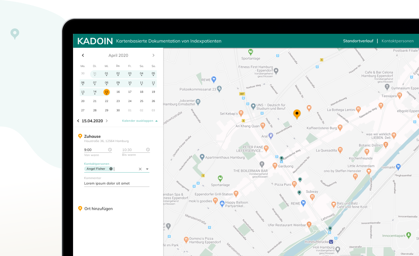
With its basis in Google Maps, authorities can use KADOIN to trace, faster and more simply, who came into contact with whom and when. Infected private individuals can, however, also import their location sequence and select, upload and edit data from the timeline. An important contribution in the fight against the virus. To protect personal data as far as possible, KADOIN runs as a front-end application, exclusively in the browser. As a result, data is held only temporarily. The application is available on a wide variety of devices.
Concentrated know-how to curb the pandemic
Working together with the MHH and BMG, in KADOIN we have developed an effective tool to reduce the spread of pandemics such as the coronavirus. Our contribution:
Consulting, concept, design, web development and licensing of Google Cloud
Straightforward user interaction through the integration of familiar interfaces such as Google Maps and Google Maps Autocomplete
Optimized user experience with Google’s Material Design, one of the most popular graphical interfaces
Reduced transformation effort for import functions by adapting the main data structure to Google Location History takeout
The development of a map-based documentation platform simplifies the work of the health authorities. In addition, a structured data collection offers a major potential for detecting and breaking chains of infection. Thanks to the combination of medical and technical specialisms, the cooperation between MHH and Ubilabs led to valuable results very quickly.