How are BigQuery, Data Clean Rooms, and 300M POIs transforming location intelligence? Our Google Maps expert Philipp Lauser answers the most critical questions about Google’s Places dataset for strategic data analytics.
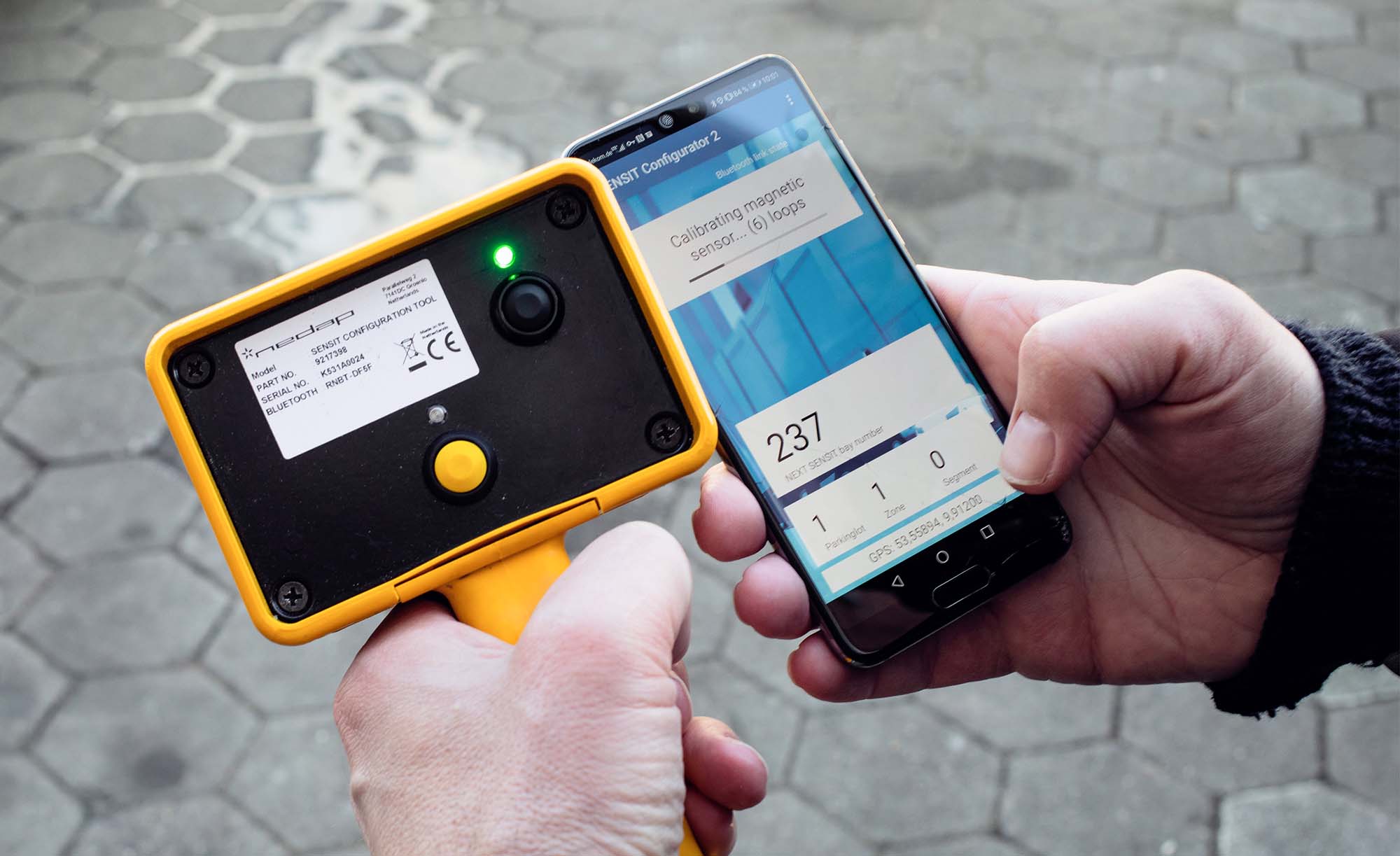
Since spring 2020, Deutsche Telekom’s Urban Mobility/Smart City division has been fitting smart sensors in car parking areas in German cities and municipalities as parts of various projects. How we can all benefit from this explains Jens Wille, a geodata expert, in an interview.
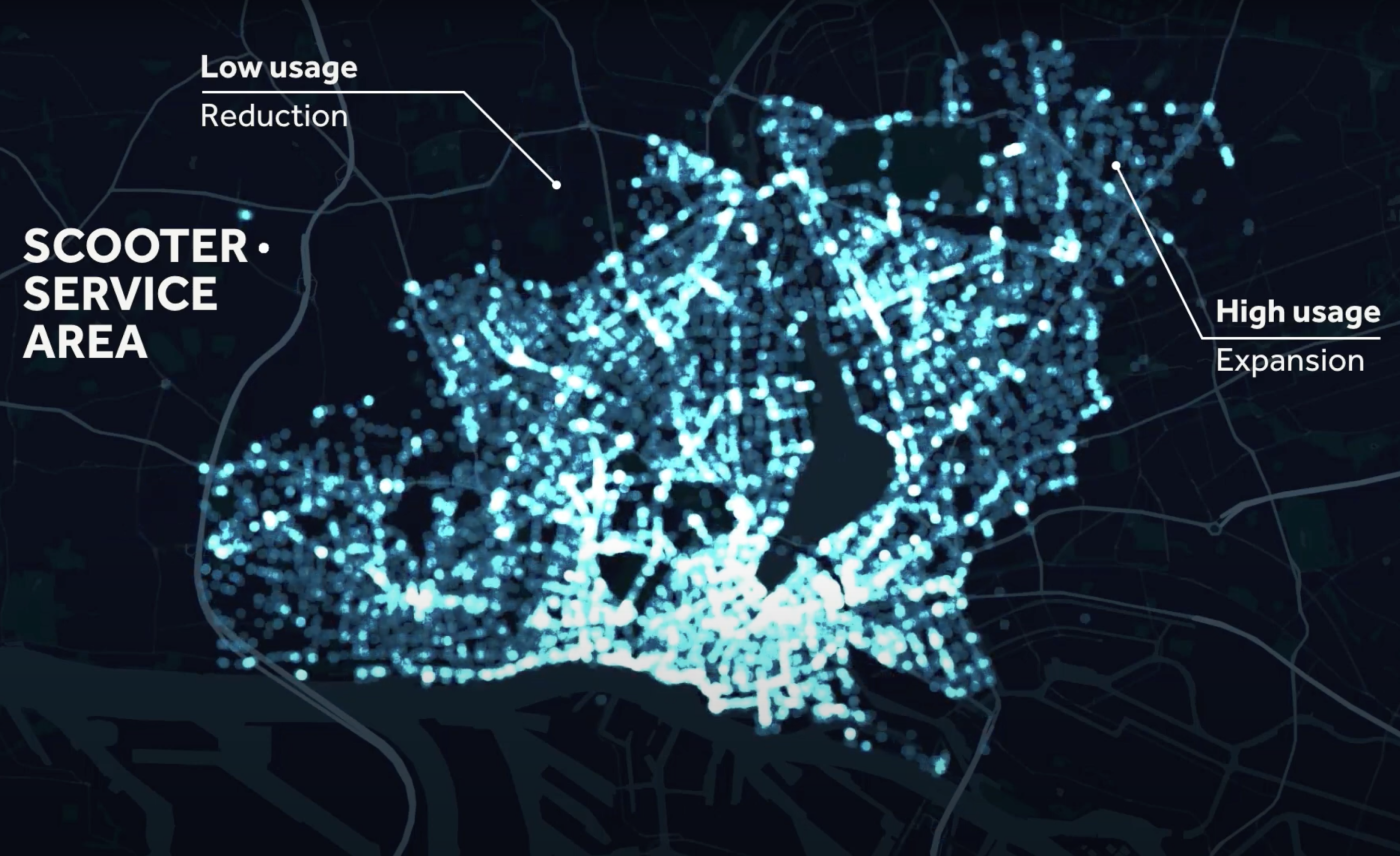
Whether carpooling or carsharing, we help to make shared mobility even better. With analyses for companies that wish to shape this future-orientated form of mobility as central actors …
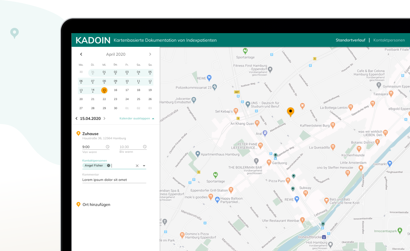
The coronavirus pandemic has posed enormous challenges and new questions to the world. How can the spread of the virus be contained? How can health authorities work more efficiently and how can infection chains be broken? Our response: KADOIN.
Ubilabs has successfully completed the Data Analytics Partner Specialization in the Google Cloud Partner Specialization Program. With this, Ubilabs has proven its expertise and success in developing customer solutions in the field of data analytics using Google Cloud Platform technology.
CAPinside’s dynamic growth required a future-proof cloud service architecture that could ensure scalability and flexibility in an agile environment. We have helped them achieve this. Our customer CAPinside demonstrates the advantages of moving to the …
Learn more
Newsletter
Get monthly updates on current projects, exciting use cases, and the latest geospatial data news delivered to your inbox.