How are BigQuery, Data Clean Rooms, and 300M POIs transforming location intelligence? Our Google Maps expert Philipp Lauser answers the most critical questions about Google’s Places dataset for strategic data analytics.
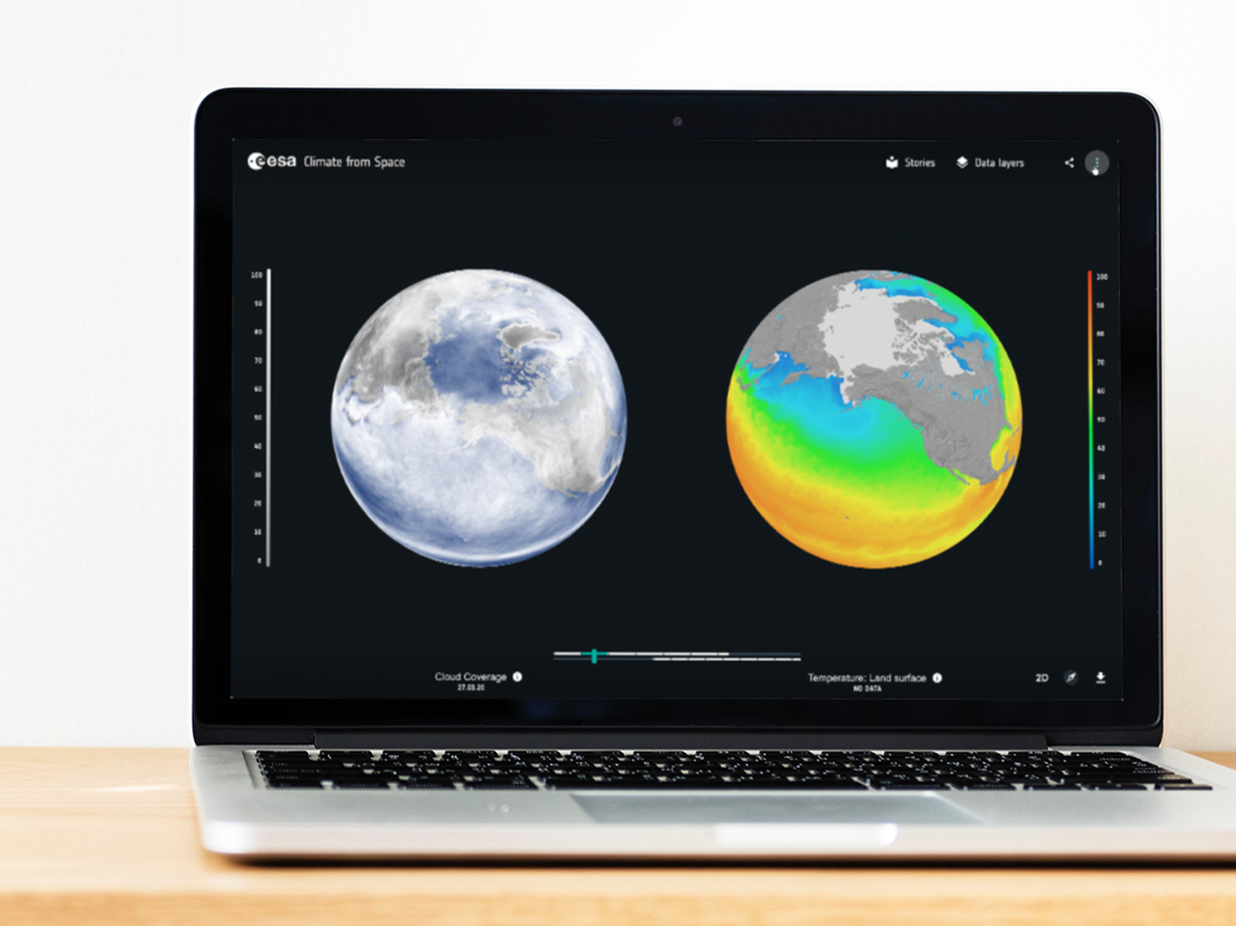
Is ozone good or bad? What causes the loss of biodiversity? The ESA’s Climate from Space platform provides answers to these questions. We have prepared the enormous amount of satellite data - and presented it in an attractive and easily understandable way. …
Register now! A five-week virtual event program will start on September 29th, providing you with impulses to master your most important challenges. And all this is free of charge. We are happy to be part of it as Google Cloud Partner - with some exciting …
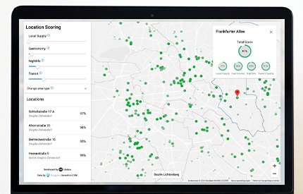
What determines the value of a property, apart from the features and condition? The location - on the one hand the region in which it is located, on the other hand the immediate surroundings that surround it. How good is the connection to public transport? …
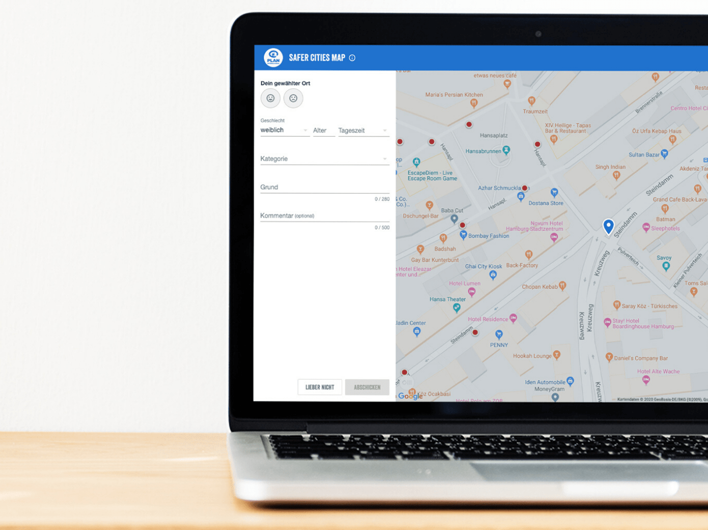
Online participation via interactive maps has been used in urban development for some time. Now companies and NGOs such as Greenpeace are also recognizing the potential of interactive maps to retain customers and engage fans. Reach and engage Millennials and …
Which customer does not want to know in what kind of neighborhood his future home or the booked hotel is located? Previously a complicated switch between different websites, the new Google Maps feature Local Context makes it easy: local information can …
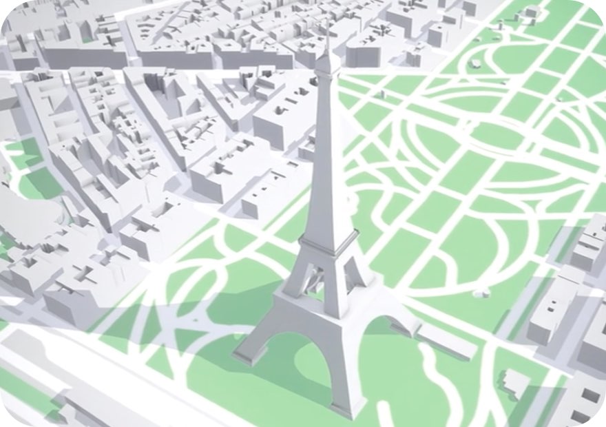
In its 15-year history, Google Maps has repeatedly set new standards. Even now, Google can come up with a number of new features. One of them is the integration of real cards into computer games. AR games on Google Maps A car chase in Tokyo, a treasure …
With corona restrictions being lifted, companies are facing the challenge of getting their employees back to the office as smoothly and safely as possible. With MapsIndoors Lite, we provide a digital solution for workplace planning in collaboration …
We were nominated for the Webby Awards again this year - and won two awards with our Carmen Sandiego game for Google Earth. Our live tracking application for the adventure race Red Bull X-Alps 2019 made it into the top 5. Play Carmen Sandiego on Google Earth …
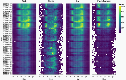
Lockdown measures are slowly being loosened - how does this affect our mobility behavior? In the first part of our Corona Mobility series we analyzed data sets up until week 13. Today we look at what has changed since the beginning of April – with new …
The Corona crisis forces us to rethink physical space and our knowledge of it. Hot spots, distances, propagation, extent and proximity. Suddenly we have to consciously think about the "where" of it. It has become essential for us to know which …
Learn more
Newsletter
Get monthly updates on current projects, exciting use cases, and the latest geospatial data news delivered to your inbox.