EDDY project creates central data basis for autonomous driving
How we make dynamic traffic data usable in an Urban Dynamic Map
A test track for intelligent vehicles, a self-driving bus and its own data portal - the city of Hamburg is a driver of innovation in the fields of smart city and mobility. So it's no wonder that the city of Hamburg is also represented in the EDDY project with various partners from research and business. The three-year research project "European Digital Dynamic Mapping" (EDDY) is developing standards for openly accessible high-resolution dynamic map data.
What will urban traffic look like in the future? How can highly dynamic traffic data be uniformly recorded and made usable? With a so-called Urban Dynamic Map, the EDDY (European Digital Dynamic Mapping) research project aims to create a central platform for data exchange and situation assessment for self-driving cars. Ubilabs is one of the project partners and, as a data analytics expert, is responsible for providing, processing and visualizing the dynamic data.
Traffic Twin: A digital image of the city
In the course of the project, static and dynamic map data will be processed and the basis created for cities, municipalities and local authorities to make this data publicly available in an Urban Dynamic Map. Decision-makers can then use this data, for example, for urban planning and traffic management.
The linchpin of the project is the development of an Urban Dynamic Map - a platform with openly accessible data relevant to urban traffic, e.g. data on infrastructure, current traffic events and weather. The digital map of traffic creates a platform that enables self-driving cars to adjust sensors and routes in time to weather events and other traffic disruptions. In addition, the development of a digital image of traffic - a traffic twin - offers other potential applications.
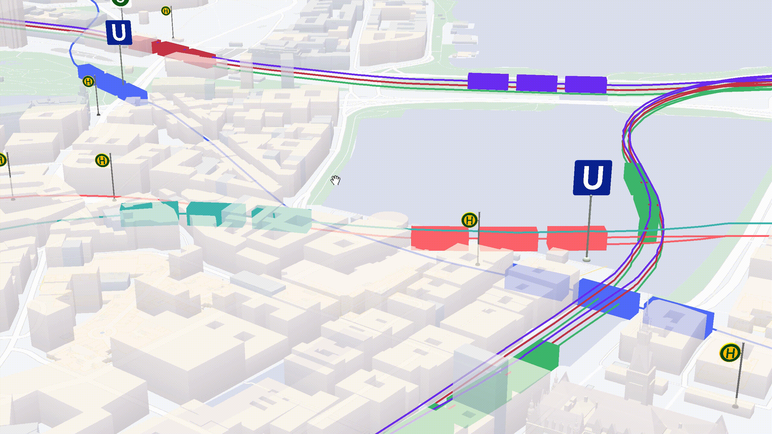
Examples for the visualization of dynamic traffic data
As a data analytics expert, Ubilabs deals with the usability of data on a daily basis. In the context of EDDY, we are primarily evaluating dynamic data sources that can be central to traffic management. To this end, we have already developed the first prototypes that process and visualize live data on weather and traffic light switching. In addition, we have created our own first traffic twin demo, "Moving Hamburg," which shows the potential of such a solution.
Our rain radar demo is the first step towards answering relevant traffic questions: How does a storm affect rail traffic, for example, and what does a rain shower mean for the sensor technology of self-driving cars? The demo visualizes the precipitation data from the Open Data Portal of the German Weather Service in 3D and shows not only the current precipitation but also a rain forecast and a rain review. If such dynamic data is integrated into the Urban Dynamic Map, autonomous driving cars can use the weather information in advance of a trip to make calibrations in the sensor system or take a safe detour in the event of extreme events such as heavy rain.
Another small prototype for the processing of dynamic traffic data is our Traffic Lights Demo. Based on open live data, we visualize the traffic light switching in Hamburg in real time - another step on the way to the public provision and use of dynamic traffic data, which until now can only be queried via the city IT. Intelligent vehicles can use the processed data as useful input.
With our demo "Moving Hamburg" we have created a digital twin of the city of Hamburg, on which real-time information on public transport can be found, including stops, travel times and routes, and accessibility of means of transport.
The realistic representation of the city in three dimensions, combined with public transport data, is just one of many ways to use a Traffic Twin. The processing of dynamic traffic data gives decision-makers the tools to manage all the information that affects traffic.
Traffic Twins and the future of intelligent traffic
What our demos show: With digital twins, we can create images of our cities that enable analysis and planning scenarios that would not be feasible in the real world. Three-dimensional representations allow complex datasets to be better placed in their urban context, providing greater access to data.
With the development of an Urban Dynamic Map, we are creating a new, comprehensive traffic data image of the city that can be used as a basis for intelligent traffic control and autonomous driving.


EDDY is funded by the Federal Ministry of Transport and Digital Infrastructure with 2,585,406 euros as part of the mFUND innovation initiative.