How can complex climate data be made accessible? For ESA, Ubilabs transformed the “Climate from Space” platform into an interactive storytelling experience with 3D navigation. Here is a look at the technological highlights.
2023 was a year full of momentum. We made progress with new technologies and projects - especially in the areas of sustainability, smart city and 3D. And with many great moments together, there was no standstill in our team either.
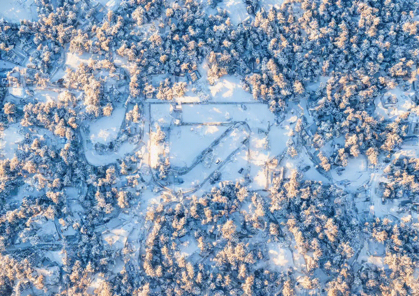
Operating ski resorts efficiently – that is the purpose of SNOWMASTER, the software suite from TechnoAlpin. For the 2023/2024 season, we have added a map to the tool that visualizes snowmaking in ski resorts in 3D.
A deforestation-free and sustainable palm oil supply chain is the goal of Unilever's actions in Southeast Asia. To bring the five landscape programs they support into the spotlight, we created a Google Earth Story that pushes the boundaries of the application.
At Next '23, Google presented three new APIs on pollen, air quality, and solar energy. In this interview, Patrick Mast, project manager at Ubilabs, gives us insight into the benefits of the APIs and the potential of Google's sustainability initiative.
In this tutorial, our developer Kat shows you how easy it is to visualize your own location data. She walks you through Google’s Data-driven styling for datasets in just 10 steps, using public transport data from Hamburg as an example.
Data, cloud, machine learning – that's where Andreas Balster comes in. He loves to solve data challenges for our customers and prefers to spend his free time off the computer.
When planning a vacation, the weather plays an important role. While some vacationers prefer hot places, others would rather travel to cooler areas. Our travel weather approach puts the weather at the center of vacation planning.
To make FS Fehrer Automotive's production facilities more efficient and better monitored, we used Google Cloud and Looker to develop dashboards that are easy for all employees to use and clearly display optimization potential.
One of the toughest adventure races celebrates its 20th anniversary this year. For the third time, we are accompanying the event with 2D and 3D tracking, which we have expanded this year with exciting features.
Learn more
Newsletter
Get monthly updates on current projects, exciting use cases, and the latest geospatial data news delivered to your inbox.